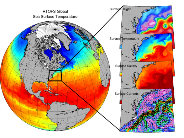
The global operational Real-Time Ocean Forecast System (Global RTOFS) at the National Centers for Environmental Prediction is based on an eddy resolving 1/12° global configuration of HYCOM (HYbrid Coordinates Ocean Model)/CICE4 (Los Alamos Sea Ice Model), and a muti-variate 3DVar data assimilation system, RTOFS-DA. Global RTOFS is part of a larger national backbone capability of ocean modeling at the National Weather Service and was developed in strong partnership with the US Navy.
This webpage provides information on operational RTOFS forecast skill.
Please use the links on the left to navigate to RTOFS verification statistics.
Additional Information:
The Global RTOFS ocean model runs once a day and produces a nowcast and 8 days of forecasts. Daily initializations include daily analyses with RTOFS-DA, a multi-variate, multi-scale 3DVar ocean-ice system with quality control and variational analysis. Observations assimilated include 1) satellite and in-situ Sea Surface Temperature, from METOP, JPSS-VIIRS, ships, and buoys; 2) satellite Sea Surface Salinity from SMAP, SMOS; 3) profiles of temperature and salinity from XBT, CTD, Argo floats, buoys, gliders, Alamo floats, and animal-borne sensors; 4) Absolute Dynamic Topography from Jason, Cryosat, Altika, and Sentinel; 5) sea ice concentration from SSMI, and AMSR. Other observing systems will be included in the near future.
The current operational version of the RTOFS is version 2.3 as of 8/2/2022. The service change notice can be found here. Verification for the operational GFS and other operational global models can be found by navigating the links to the left.
Verification is done using the EMC Verification System (EVS), which uses METplus.