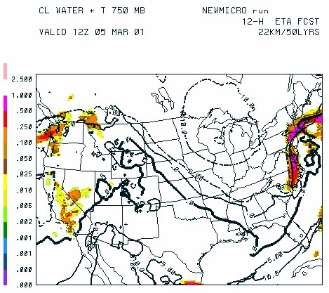
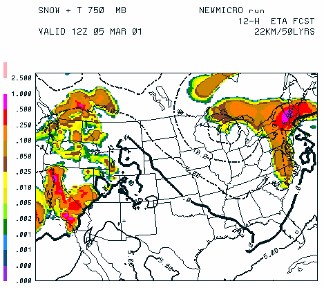
Figure 3.4(a) Mixing ratios (in g/kg) of cloud water (left), rain (center),
and snow (right) at 750 mb valid at 12Z on 5 March 2001. Bold solid line is the 0C
isotherm, dashed lines are for colder temperatures, and solid lines are for warmer
temperatures. Note the presence of supercooled cloud water with snow in the Pacific
Northwest, the Sierras, the mid Atlantic, and southern New England. A small amount
of supercooled rain is seen over northern New Jersey and southern New York. The
small area of supercooled rain along the Washington-Idaho border is a result of
vertical interpolation from model coordinates to pressure coordinates.
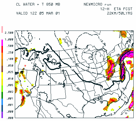
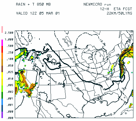
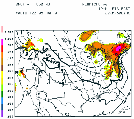
Figure 3.4(b) Same as above except at 850 mb. The greater presence of
rain, particularly along the west coast, is primarily due to the melting of snow
falling from higher levels. An area of supercooled cloud water associated with a
shallow, post-frontal cloud system formed by upslope flow over the Appalachian
mountains. The small area of rain over West Virginia is likely due to the
autoconversion of supercooled cloud water to rain.
